Plitvice Lakes National Park, Croatia: Nature’s Masterpiece
In 1979, Plitvice Lakes National Park was added to the UNESCO World Heritage register among the first natural sites worldwide. Each year, more than 1.1 million visitors are recorded.
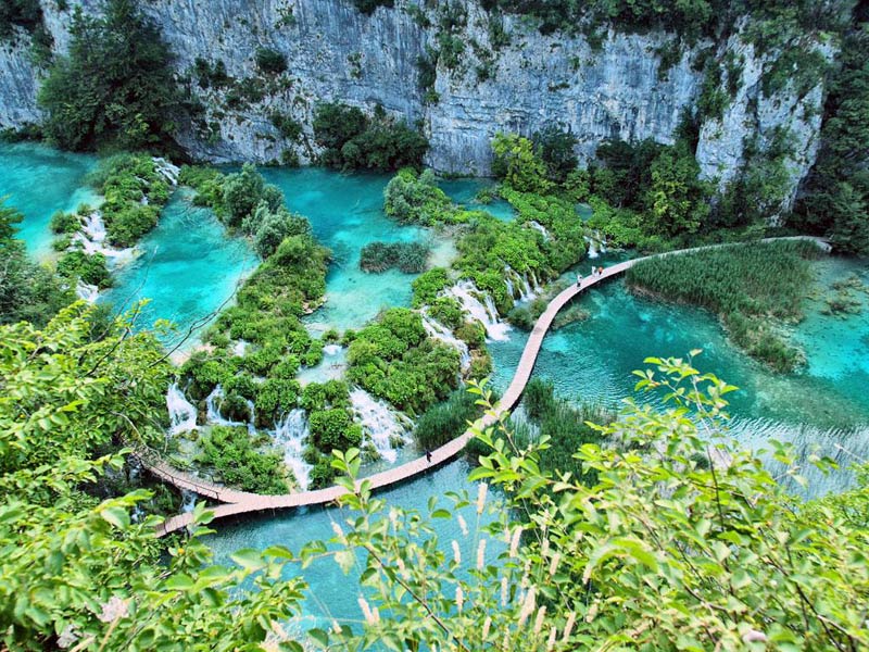
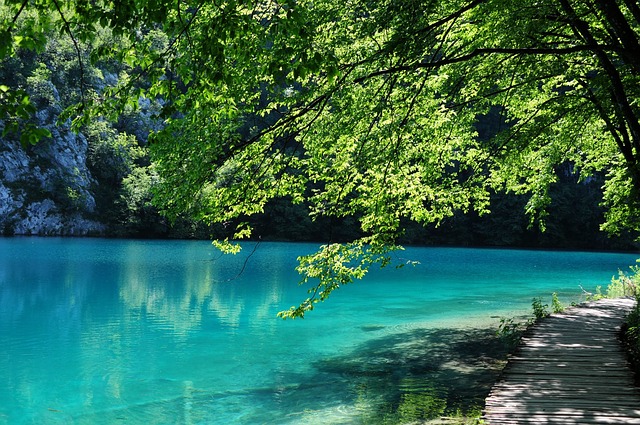
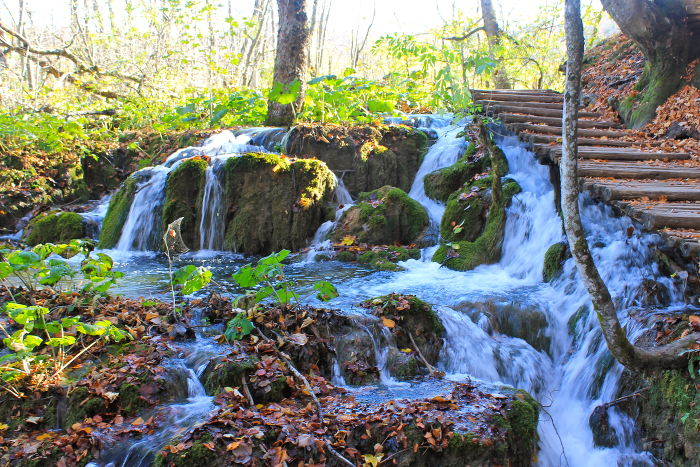
Within the boundaries of this heavily forested national park, 16 crystalline lakes tumble into each other via a series of waterfalls and cascades. The mineral-rich waters carve through the rock, depositing tufa in continually changing formations. Clouds of butterflies drift above the 18km of wooden footbridges and pathways which snake around the edges and under and across the rumbling water.
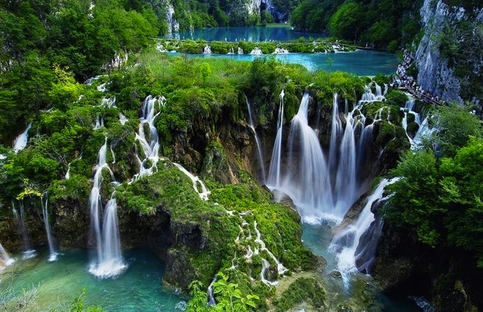
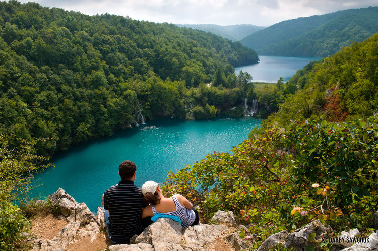
It takes upwards of six hours to explore the lakes on foot, or you can slice two hours off by taking advantage of the park’s free boats and buses (departing every 30 minutes from April to October). From Entrance 2, catch the bus to the top of the upper lakes and wander back down to the shore of Kozjak , the park’s largest lake (about 4km in length). A boat will whisk you from here to the lower lakes, where the circuit culminates in the aptly named Veliki Slap , the tallest waterfall in Croatia (78m). The path then climbs steeply (offering great views and photo opportunities) to a bus stop, where you can grab a lift back to Entrance 2.
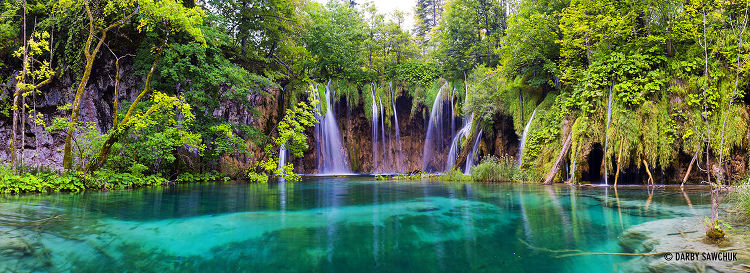
The national park is world famous for its lakes arranged in cascades. Currently, 16 lakes can be seen from the surface. These lakes are a result of the confluence of several small rivers and subterranean karst rivers. The lakes are all interconnected and follow the water flow. They are separated by natural dams of travertine, which is deposited by the action of moss, algae, and bacteria. The particularly sensitive travertine barriers are the result of an interplay between water, air and plants. The encrusted plants and bacteria accumulate on top of each other, forming travertine barriers which grow at the rate of about 1 cm (0.4 in) per year.
The sixteen lakes are separated into an upper and lower cluster formed by runoff from the mountains, descending from an altitude of 636 to 503 m (2,087 to 1,650 ft) over a distance of some eight km, aligned in a south-north direction. The lakes collectively cover an area of about two square kilometres (0.77 square miles), with the water exiting from the lowest lake forming the Korana River.
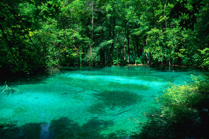
The lakes are renowned for their distinctive colors, ranging from azure to green, grey or blue. The colors change constantly depending on the quantity of minerals or organisms in the water and the angle of sunlight.
Comments are closed.